
This Peaceful Trail Is Right Under Most People's Noses
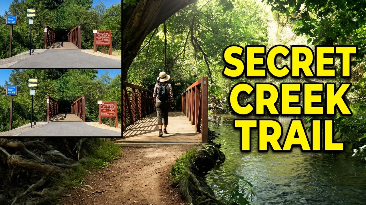
A quiet creekside trail with a footbridge crossing — proof you don't need to drive hours to find a good hike.
About This Route
This Peaceful Trail Is Right Under Most People's Noses
A quiet creekside trail with a footbridge crossing — proof you don't need to drive hours to find a good hike.
This one stays shaded almost the whole way, crosses the creek on a footbridge, and doesn't need a long drive to get to — the kind of local trail that's easy to overlook. Most people take the easy path that is flat, paved, easy to traverse. But take a few steps off the main path and a whole new world opens up! This bike path in San Jose, CA has an accompanying dirt path that wanders to and fro along the Los Alamitos Creek.
Planning Your Visit to the Los Alamitos Creek Trail
Tucked into the Almaden Valley on the southwest side of the Santa Teresa Foothills, the Los Alamitos Creek Trail is one of those routes thousands of people drive past every day without ever really seeing. The paved path runs roughly four miles from Almaden Lake Park south toward McKean Road, connecting onward to the Calero Creek Trail — and from there, to Santa Teresa County Park and Calero County Park. It's flat, it's shaded, and it's genuinely quiet once you're a few hundred yards in.
What makes it worth a video rather than just a walk is the second trail. Running alongside the asphalt for much of its length is an unpaved footpath that dips closer to the water, wanders under the oaks and sycamores, and rejoins the main path a few hundred feet later. Most people never step onto it. That dirt track is the "secret creek trail."
Trail Details & Terrain
- Distance: About 4 miles one way from Almaden Lake Park to the southern end; easy to turn into a 2–4 mile out-and-back of whatever length suits you.
- Elevation: Essentially flat — this is a valley-floor creek walk, not a climb.
- Surface: The main route is smooth asphalt roughly six feet wide, stroller- and wheelchair-friendly, with several designated accessible parking spaces at the trailheads. The parallel dirt path is uneven, rooty in places, and occasionally muddy after rain.
- Shade: Riparian canopy for much of the route — a real advantage in a South Bay summer, and a meaningful contrast to the fully exposed grassland hiking a few miles east at Santa Teresa.
- Who it's good for: Almost anyone. This is the trail to hand someone who says they're "not really a hiker." It's also a good early-morning or after-work option when a bigger drive isn't realistic.
Note that the trail splits into two parallel tracks in several places and merges again further on, and there are a handful of road crossings along the way. There's also a fitness parcourse near the northern stretch if you want to make the walk into something more.
The Story Under the Creek
The quiet is a little deceptive. This creek has one of the more consequential industrial histories in California.
At the headwaters sits the New Almaden Mining District — the largest-producing mercury mine in North America and the fifth largest in the world. Mercury (quicksilver) mined here was shipped to the Sierra foothills and used to extract gold during the Gold Rush; in a real sense, the California Gold Rush ran on this valley. Mining and processing operated from the mid-1840s until 1971, and over that span an estimated 6,500 tons of mercury were released into the creeks and rivers of the upper Guadalupe watershed.
That legacy is still in the sediment. Alamitos Creek carries mercury-laden sediment downstream, and posted signs along the creek advise against eating fish caught here. It's a striking thing to walk past on an otherwise peaceful morning — a reminder that "natural-looking" and "untouched" are not the same thing.
A few more things hiding in plain sight:
- The lake is a former gravel pit. Almaden Lake isn't natural. Quarry operations dug three large pits alongside the creek starting in the 1940s; after operations ceased, storm events eroded the levee separating the creek from the quarry, and the pits flooded. San Jose took the site over as a public park in 1982. The lake bottom is still unnaturally irregular, with submerged remnant dikes from the quarry days.
- Steelhead still try. Threatened Central California Coast steelhead move through this system. Because the creek currently flows through the lake, young fish can lose their way there and get picked off by non-native bass. Valley Water designed a project to separate the creek from the lake and restore a direct channel to the Guadalupe River — but the board put construction on hold in January 2023 over rising costs, with no restart timeline. In the meantime, park recreation is unaffected.
- "Los Alamitos" translates from Spanish roughly as "the little cottonwoods" — a name for the trees, from a time when the trees were the notable thing about the place.
Wildlife Along the Creek
For an urban trail, the wildlife list is better than it has any right to be. Expect wild turkeys, black-tailed deer, coyotes, red-shouldered hawks, egrets, and herons, plus a steady soundtrack of songbirds in the riparian corridor. Egrets and herons nest on the island at Almaden Lake. Early morning is by far the best window for all of it, and it's the best light for filming, too.
Parking, Access & Rules
- Camden Avenue lot (recommended): Just off Camden Avenue, near the pedestrian bridge. From CA-85, exit Almaden Expressway, head south 2.5 miles, turn left on Camden Avenue and continue about half a mile past the Westgate Church South Campus; the lot is on the left. Free, and it puts you right at the middle of the good stretch.
- Almaden Lake Park (Winfield Boulevard): The northern trailhead. Day-use parking fees apply here. It's also the connection point to the Guadalupe River Trail.
- Street parking: Available along Winfield Boulevard and near Greystone Park and Carabelle Park.
- Public transit: VTA light rail and bus both reach the Almaden Lake area — a VTA bus stop sits at Winfield Boulevard and Coleman Avenue — so you can skip the parking fee entirely.
- Hours: Generally one hour before sunrise to one hour after sunset.
- Restrooms: At Almaden Lake Park off Winfield Boulevard, and at Greystone Park at Camden Avenue and Mt. Carmel Drive.
- Dogs: Welcome, on leash.
- Fishing: Catch-and-release only in practice — do not eat fish caught in this watershed. Mercury advisories are posted for good reason.
If You Want More Trail
One of the best things about this route is what it connects to. The Los Alamitos Creek Trail links to the Calero Creek Trail, which continues toward the Fortini and Stile Ranch trailheads at Santa Teresa County Park — the hike in our previous video. End to end, it's roughly 8.4 miles from the Guadalupe River Trail entrance at Chynoweth to the Stile Ranch trailhead. Walk the shaded creek in the morning, climb into the open grassland in the afternoon, and you've seen two completely different versions of the same valley in one day.
For current trail information, hours, and access details, visit the City of San José trail page for Los Alamitos Creek Trail
Check out our gear list – These are items we use regularly, some we even review for you!
Sources & Reference Links
- City of San José — Los Alamitos Creek Trail: https://www.sanjoseca.gov/Home/Components/FacilityDirectory/FacilityDirectory/2997/2058
- Valley Water — Almaden Lake Improvement Project (mercury figures, steelhead, project-on-hold status): https://www.valleywater.org/project-updates/almaden-lake-improvement-project
- Santa Clara Valley Bird Alliance — Los Alamitos Creek Trail birding guide (parking, restrooms, hours, trail surface): https://scvbirdalliance.org/self-guided-birding/los-alamitos-creek-trail
- Bay Area Hiker — Alamitos Creek Trail: https://bahiker.com/southbayhikes/alamitoscreek.html
- Bay Area Back Pages — Los Alamitos Creek Trail (mileage to Stile Ranch trailhead): https://www.rhorii.com/BABP/losalmts.html
- EPA — Guadalupe River Mercury TMDL Implementation Report (New Almaden district ranking): https://19january2021snapshot.epa.gov/sites/static/files/2015-07/documents/13-guadalupe-river-mercury-tmdl-implementation-report-2015-06-15.pdf
- CDFW Office of Spill Prevention and Response — New Almaden Mine (1845–1971 operating dates): https://wildlife.ca.gov/OSPR/NRDA/New-Almaden-Mine