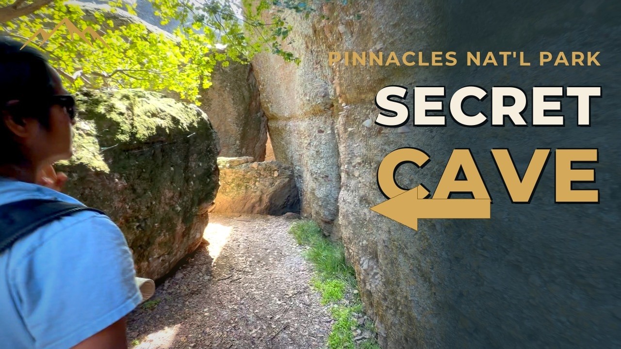
Pinnacles National Park Cave's | Most Hikers Miss This
Inside Pinnacles National Park's talus caves — a side route most hikers walk right past.
About This Route
Bear Gulch Cave, Pinnacles National Park
Pinnacles National Park's talus caves hide a route most hikers walk straight past — this one goes through it. Join us on an unusually hot day in March 2026 as we ascend through some amazing caves full of rushing water. A cold and noisy inclave among a dry and hot landscape. Truly a wonderful place! The best time to visit Pinnacles is spring (March & April). The weather is starting to warm (on this March visit it was hot!), but the vegetation is still green, and often the water is still flowing. Once summer starts in earnest - June through August - this park is HOT and DRY! Keep this in mind if you want to compare Pinnacles National Park and Yosemite National Park. Or if you want to compare to other US National Parks. You can avoid a lot of driving and crowds by visiting Pinnacles, but the time of year can make a big difference.
Planning Your Visit to Bear Gulch Cave
Pinnacles National Park sits about an hour and a half south of San Jose, in the Gabilan Range east of the Salinas Valley — close enough for a long day trip, far enough that most Bay Area hikers have never been. It's one of the smallest and least-visited national parks in California, and the thing that makes it worth the drive isn't the summit views. It's what's underneath them.
The Bear Gulch Cave Trail climbs through a talus cave — a passage formed not by lava or dissolving limestone, but by enormous boulders that fell into a narrow gorge and wedged there, roofing over the creek below. You walk up through the gaps they left. Parts of it are genuinely dark, parts require ducking and squeezing, and there's water running under your feet for much of the year. It's the rare hike where a headlamp isn't optional gear.
Trail Details & Terrain
- Distance: About 1.5 miles round trip from the Bear Gulch Day Use Area to the reservoir and back; roughly 2 miles if you park at the lower lot.
- Elevation gain: Around 275 feet — modest on paper, but concentrated in the cave section.
- Difficulty: Moderate. Not because of distance or climb, but because of the cave itself: uneven footing, low ceilings, wet rock, and a few genuinely tight squeezes. There are stone steps and handrails through the steepest parts.
- Time: 1 to 2 hours, longer if you stop at the reservoir (you should).
- Route: From the Bear Gulch Day Use Area, follow signs for Moses Spring Trail. At the second junction, going left takes you up through the cave; right stays on Moses Spring Trail along the rim. Both are about a sixth of a mile and rejoin just below the reservoir — so if someone in your group would rather skip the cave, the group can split and meet up again without anyone backtracking.
- Honest framing: Most reasonably mobile people handle this fine. Kids no problem at all and they love it. But if you're strongly claustrophobic, or unsteady on uneven wet rock, take the Moses Spring rim route instead. There's no shame in it and you still get the reservoir.
The Cave Itself — What It's Actually Like
The approach doesn't prepare you for it. The first stretch is a shaded, ferny, almost mossy walk through a riparian canyon with picnic tables and big boulders — pleasant, ordinary, easy. Then the boulders get larger, the canyon narrows, and you reach a small sign and an opening under a rock the size of a house.
Inside, the light goes fast. Talus caves aren't fully sealed — daylight leaks through the gaps between boulders in shafts — but there are stretches where it's genuinely dark and you're navigating by headlamp with a hand on cold rock. A seasonal stream runs through the passages, so expect wet feet, and after heavy winter rain you'll hear waterfalls moving through the cave system before you see them.
A few things we'd tell a friend before they went:
- Bring a real light, one per person. A phone flashlight technically works but leaves you one-handed on rock where you'd rather have both hands free. Headlamps are the right call.
- Watch your head, constantly. The low points arrive without warning, and the rock does not give.
- Keep your voice down and skip the flash. These are bats' homes, and flash photography and noise genuinely disturb them.
- The exit is a squeeze. Getting out is tighter than getting in — worth knowing in advance rather than discovering it mid-passage.
- It's cold in there. Pleasant in summer, bracing in winter. The temperature drop from the trail is noticeable.
The Bats — Why the Cave Closes
Bear Gulch Cave is home to a colony of Townsend's big-eared bats, a species of special concern in California, and this is the largest maternity colony between San Francisco and Mexico. That's the reason the cave operates on a schedule rather than staying open year-round.
Here's the pattern to know before you plan a trip:
- The entire cave is typically closed roughly mid-May through mid-July while the bats raise their pups.
- The lower (main) chamber is generally open the rest of the year — around ten months annually — thanks to a set of gates the park installed in 2004 that separates the sections.
- The upper chamber opens only a few weeks each year, usually around March and October, depending on where the bats are.
- Caves can also close on short notice for high water during and after storms.
The park counted roughly 378 bats during hibernation in one survey season, which is a startling number to sit with when you're standing inside their house in the dark.
Check the status the morning you go. Not the week before — the morning. Conditions change, and it's a long drive to find a closed gate.
Current Talus Cave Status — National Park Service
Bear Gulch Reservoir
The cave dumps you out into open sky at the top, and a short set of stone steps up the back of a dam brings you to Bear Gulch Reservoir — a still, dark pool ringed by rock spires, built by the Civilian Conservation Corps in the 1930s. It's a completely different register from the cave: bright, wide, quiet. Most people stop here for a snack, and you should.
From the reservoir, the Rim Trail heads north above the gorge and connects to the High Peaks Trail, which turns the walk into a bigger day if you want one. The Chalone Peak Trail also leaves from here toward South Chalone Peak, 4.5 miles on.
The Geology — A Volcano That Moved 195 Miles
Pinnacles is a broken piece of something that used to be somewhere else.
About 23 million years ago, a volcanic field erupted near what's now Lancaster, in Southern California. It happened to sit directly on top of the San Andreas Fault. When transform movement along the fault began, the volcano was split in two, and the western half started traveling northwest with the Pacific Plate at roughly an inch or two a year.
It's still going. The rock you're standing on has moved about 195 miles from where it formed, and its matching half — the Neenach Formation — is still sitting down near Lancaster. When geologists confirmed the two halves matched in the 1970s, it became a textbook demonstration of plate tectonics and one of the cleanest measurements ever made of offset along the San Andreas.
The talus caves are a footnote to that same story: earthquakes and erosion fractured the spires, boulders tumbled into the narrow gorges below, and the gaps between them became passages.
Condors Overhead
Pinnacles is one of a small number of California condor release sites in the country, and the only one inside a national park. Condor releases began here in 2003.
The backstory is worth knowing while you're scanning the sky: by the late 1980s the entire wild population had collapsed to around two dozen birds, and every remaining condor was taken into captivity for emergency breeding. The recovery since is one of the more remarkable conservation stories in North America. With wingspans approaching nine and a half feet, they're the largest flying land birds on the continent, and park biologists track the local birds individually.
Best odds of seeing one are early morning and late afternoon, from the High Peaks area, when thermals are working. Look for the wing tags — most park condors carry numbered ones. And don't mistake a turkey vulture for a condor; the size difference is obvious once you've seen the real thing.
Getting There, Fees & Access
- Two entrances, no road between them. The east and west sides of the park are connected only by hiking trails. Driving from one to the other takes roughly an hour and a half around the outside. Bear Gulch Cave is on the east side — enter via the east entrance from Highway 25 near Paicines.
- East entrance is open 24 hours. The west entrance runs 7:30 a.m. to 8 p.m. with a narrow, winding approach road; trailers and RVs should use the east entrance.
- Entrance fees apply and are good for seven days. Interagency and America the Beautiful passes are accepted. Confirm current rates before you go.
- Parking is the real constraint. The upper lot near the Moses Spring trailhead holds only about ten cars. On busy weekends the park runs a shuttle from the campground area, and rangers may turn cars back at the entrance when lots are full. Arrive early — before 9 a.m. on a spring weekend — or plan on the shuttle.
- Restrooms are at the trailhead parking area. There are none on the trail.
- Pets and bicycles are not permitted on park trails, including this one. Leashed pets are allowed in parking areas, roads, and picnic areas only.
- Best seasons: Spring and fall. Summer heat in this park is genuinely intense, and spring brings both wildflowers and water moving through the cave.
Pinnacles National Park — official National Park Service site · Current park conditions and alerts
⚠️ A Note on Conditions
The cave is a genuinely different environment from the trail leading to it. Bring a headlamp per person, wear shoes with grip you trust on wet rock, and be honest with yourself about tight spaces before you commit — the Moses Spring rim route is a real alternative, not a consolation prize. Water levels in the cave rise fast during and after storms, and the park closes the passages when they do. Poison oak is present throughout the park. Cell service is unreliable to nonexistent. Always check current cave and trail status with the park before you drive out.
Gear Used For This Hike
Caves are hard on camera gear and harder on lighting. Here's what we leaned on. Please consider clicking and checking these out — it helps our channel.
-
Camera Setup: Some of the gear we used for this video
- 4K Camera for this Shoot – Handled the extreme contrast between dark cave passages and blown-out daylight at the openings.
- Durable Tripod – Fairly lightweight, but definately durable.
-
Footwear: Hiking Boots – Wet rock inside the cave makes grip matter more here than on a typical day hike.
-
More Stuff: More of Our Favorite Gear – These are items we use regularly, some we even review for you!
Affiliate Disclosure: Some links above are affiliate links. As an Amazon Associate or affiliate partner, Our Own Route may earn a commission on qualifying purchases at no extra cost to you.
Sources & Reference Links
- NPS — Talus Cave Status: https://www.nps.gov/pinn/planyourvisit/cavestatus.htm
- NPS — Current Conditions (cave chamber structure, closure reasons): https://www.nps.gov/pinn/planyourvisit/conditions.htm
- NPS — Opening of Bear Gulch Cave (bat colony counts, 2004 gates, closure dates): https://www.nps.gov/pinn/learn/news/bgcaveopen.htm
- NPS — 2021 Resumption of Fees (fee structure — verify current rates): https://www.nps.gov/pinn/learn/news/5-1-2021-resumption-of-fees.htm
- Hikespeak — Bear Gulch (mileage, elevation, trail junctions, Chalone Peak Trail): https://www.hikespeak.com/trails/bear-gulch-pinnacles-national-monument/
- Wikipedia — Neenach Volcano (195-mile offset, plate tectonics significance): https://en.wikipedia.org/wiki/Neenach_Volcano
- Save Mount Diablo — Exploring the Diablo Range: Pinnacles: https://savemountdiablo.org/diablo-range-revealed/exploring-the-diablo-range-pinnacles-national-park/
- NBC News — America's Newest National Park Declared (condor release site status, 2013 designation): https://www.nbcnews.com/id/wbna50435021